
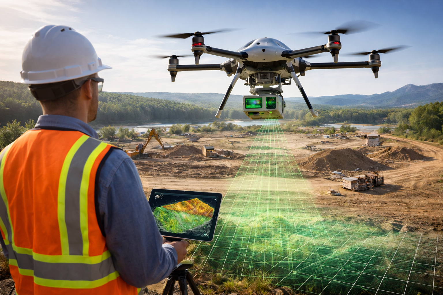
Drone LiDAR has moved from “specialist kit” to something many survey, construction, mining, forestry, and utility teams can actually budget for and run week to week. The core idea is simple. A LiDAR unit sends out laser pulses, measures the time it takes for returns to come back, and builds a 3D point cloud.
What changed is everything around that core idea.
In 2026, you can pick from:
- Turnkey, tightly integrated payloads that pair LiDAR, IMU, and a mapping camera and push you toward a mostly single-vendor workflow, such as DJI Zenmuse L2
- Survey-grade modular systems where the LiDAR engine and the GNSS INS stack are selected for your accuracy and vegetation needs, such as YellowScan Voyager paired with an Applanix unit
- SLAM-first systems for GNSS-denied work like tunnels, shafts, plants, and confined spaces, such as Emesent Hovermap and the Flyability Elios 3 Surveying Payload
At the same time, the “rules of the road” for quality and compliance have gotten clearer. USGS updated its Lidar Base Specification with a 2025 revision and tracked changes to accuracy language and metrics.
This guide walks you through what Drone LiDAR looks like today, where teams win or lose accuracy, what to budget for, and how to pick the right setup for your jobs.
Drone LiDAR 101
Drone LiDAR is a stack:
- Laser scanner: Measures ranges by sending pulses and timing returns.
- Trajectory solution: GNSS + IMU combine to tell you where the sensor was and how it was oriented at the exact moment each pulse fired.
- Calibration and alignment: Boresight angles and lever arms tie the LiDAR frame to the IMU frame and then to the GNSS frame.
- Processing and QA: Strip alignment, noise filtering, classification, surface generation, accuracy testing.
You can buy an excellent scanner and still deliver a weak DTM if the IMU is low grade, the GNSS data is poor, your calibration is off, or your classification is rushed.
That is why modern standards lean hard on how you report accuracy and how you test it, not just what a brochure claims.
The technology basics
Return & Multiple Returns
A single pulse can hit multiple surfaces. Think canopy, branches, understory, then ground. Systems that support multiple returns per shot give you more chances of getting ground points in vegetated areas.
- DJI Zenmuse L2 lists support for up to 5 returns.
- YellowScan Surveyor Ultra lists up to 3 echoes per shot.
- YellowScan Voyager lists up to 32 echoes per shot (paired with a RIEGL scanner).
Returns matter most in forests, scrub, riparian areas, rail corridors with heavy vegetation, and any project where bare-earth is the deliverable.
Point rate vs useful point density
Point rate is how many points the system can output per second. Density is how many points you actually get per square meter on the ground.
Density depends on:
- altitude AGL
- ground speed
- scanner field of view and scan pattern
- overlap and line spacing
- what the surface reflects back
Example from published specs:
- DJI L2 lists 240,000 pts/s single return and 1,200,000 pts/s multiple returns.
- YellowScan Surveyor Ultra lists up to 640,000 shots per second and quotes a sample density of 60 pts/m² at 100 m AGL and 10 m/s.
- YellowScan Voyager lists up to 2,400,000 shots per second and quotes 24 pts/m² at 300 m AGL and 30 m/s.
If you are bidding work, density estimates should be based on your planned altitude, speed, and overlap, not just the sensor’s max output.
Wavelength and eye safety
Most drone mapping systems you will see in 2026 are 905 nm and classed as Class 1 for laser safety.
DJI L2 has:
- 905 nm wavelength
- Class 1 (IEC 60825-1:2014)
This matters for operator safety and for how the beam interacts with certain surfaces. The bigger practical point is that reflective surfaces, water, and some dark materials can still cause weak returns or noisy data.
Scan pattern and field of view
Scan pattern affects coverage and the geometry of your point cloud.
DJI L2 has two modes:
- Repetitive scanning pattern with 70° horizontal and 3° vertical FOV
- Non-repetitive scanning pattern with 70° horizontal and 75° vertical FOV
So it’s not “bigger FOV is better.” It is “scan geometry must fit your terrain, your altitude, and your deliverable.” A wide vertical FOV can help capture vertical features, but it also changes incidence angles and can influence noise and shadowing around structures.
Drone LiDAR Hardware
Turnkey integrated payloads
DJI Zenmuse L2
DJI’s L2 is a good example of where the mainstream market has gone: LiDAR, IMU, and an RGB mapping camera packaged into a single payload with a vendor-led processing route.
You get:
- 905 g payload weight
- IP54 rating
- detection range examples 450 m at 50% reflectivity and 250 m at 10% reflectivity
- system accuracy claims 5 cm horizontal and 4 cm vertical at 150 m under stated test conditions
- ranging accuracy 2 cm RMS (1σ) at 150 m
- 240 kHz pulse emission frequency
- laser beam divergence 0.2 mrad horizontal and 0.6 mrad vertical
It is also explicitly positioned as a “single flight coverage” tool, with DJI marketing 2.5 km² per flight under their assumptions.
That type of integration lowers friction for teams that want repeatable outputs with fewer moving parts, especially for corridor mapping, earthworks, and site modeling where the drone can stay within typical altitude limits.
DJI Zenmuse L1
L1 remains in the market, coming with:
- point rate up to 240,000 pts/s single return and 480,000 pts/s multiple return
- system accuracy (RMS 1σ) of 10 cm horizontal and 5 cm vertical at 50 m
So the L2 sits as DJI’s more recent integrated option with updated performance claims and scanning behavior. Your choice tends to hinge on budget, required deliverables, and how much you want the DJI-to-DJI processing path.
Survey-grade modular systems and higher-end stacks
If you need tighter accuracy, better canopy penetration, higher flight altitudes (where allowed), or better behavior on complex terrain, you will see systems built around different scanners and GNSS INS units.
YellowScan Surveyor Ultra
YellowScan has a compact spec set that makes it easy to understand where it fits:
- 2.5 cm accuracy and 3 cm precision (as stated by the vendor)
- typical flight speed 10 m/s
- max AGL 140 m
- example density 60 pts/m² at 100 m AGL and 10 m/s
- scanner Hesai XT32M2X
- GNSS inertial solution SBG Quanta Micro
- 360° x 40.3° FOV
This profile is typical of “mid-weight survey payload” thinking: manageable weight, high productivity, and enough accuracy for many topo and engineering jobs when flown well.
YellowScan Voyager
Voyager is positioned for higher altitude and longer range work:
- accuracy 1 cm and precision 0.5 cm (vendor stated)
- max AGL 440 m
- range up to 1250 m
- RIEGL VUX-120 scanner
- GNSS INS options Applanix AP+ 30 AIR or AP+ 50 AIR
- up to 2,400,000 shots per second
- up to 32 echoes per shot
This kind of configuration is built for demanding corridor and terrain mapping, and it illustrates a key 2026 reality: drone LiDAR is no longer limited to lightweight sensors if you have the aircraft and approvals to run heavier payloads.
RIEGL miniVUX series
RIEGL remains a reference point for waveform-capable LiDAR in aviation. On the miniVUX-1UAV page, RIEGL highlights waveform processing and multi-target resolution for foliage penetration, and notes that system solutions can bundle GNSS IMU and cameras.
If you are comparing options, this is the “scanner-first” approach where vegetation performance and echo processing are a central part of the buy decision, not an afterthought.
GeoCue TrueView 535
GeoCue sits in a “survey deliverables and workflow” lane, publishing both sensor and system metrics:
- usable range 120 m at 20% reflectivity
- 32 beams and 3 returns
- PRR 640 kHz
- scanner accuracy 20 mm and precision 10 mm (as specified)
- a stated system accuracy like typical 3 cm RMSE depending on GNSS and control conditions
GeoCue also markets a “no base station” post-processing option tied to their positioning services, aimed at reducing field complexity.
ROCK R3 Pro V2
ROCK’s R3 Pro V2 highlights a high point output and multi-mode use:
- 32 channels
- 1.28M points/sec
- vendor-stated 2–3 cm post-processed accuracy
- 360° field of view
- 1.26 kg weight with camera
- SLAM-ready language for GNSS-denied scenarios
This reflects a 2026 buyer pattern: teams want one sensor family they can fly on a drone, mount on a vehicle, and carry indoors, even if they use different processing modes.
GreenValley LiAir series
GreenValley’s LiAir X3-H page presents a compact system with:
- scan range 190 m at 10% reflectance
- ±2 cm accuracy
- 1.25 kg weight
- IP rating called out as IP64 on the product page
GreenValley also sits on the software side with LiDAR360, which is widely used for point cloud processing and includes AI and ML language in its positioning.
Aircraft and payload trends for Drone LiDAR
Heavier lift drones are more common in mapping programs
A big reason LiDAR adoption has widened is that more teams now run aircraft that can comfortably carry LiDAR payloads with enough flight time to stay productive.
A clear example is the DJI Matrice 400, introduced June 10, 2025, as DJI’s enterprise flagship platform. It features a:
- 59-minute flight time
- up to 6 kg payload capacity
That kind of endurance and payload capacity supports more than just mapping. It supports mixed missions such as mapping plus thermal, or mapping plus visual inspection, and it also supports heavier third-party LiDAR payloads where integration exists.
Payload integration is now a buying criterion
In 2026, you will rarely buy “a LiDAR sensor.” You buy an ecosystem fit:
- aircraft mounting options and vibration behavior
- power draw and connectors
- GNSS antenna placement
- camera integration for colorization
- processing software that supports your deliverables and coordinate systems
If your deliverables are engineering-grade surfaces and volumes, integration is about repeatability. If your deliverables are DOT corridors or vegetation analytics, integration is about long linear productivity and classification quality.
Drone LiDAR Software & Processing
This is where projects either become smooth and scalable or become a backlog.
Vendor-led processing paths
DJI pushes a clear route: collect on DJI aircraft, process in DJI Terra, export standard deliverables.
DJI’s own LiDAR guide describes DJI Terra as a raw data processing tool that outputs LAS deliverables from DJI LiDAR raw data.
DJI’s Zenmuse L2 support page also lists output formats:
- point cloud formats PNTS, LAS, PLY, PCD, S3MB
- trajectory outputs such as sbet.out and sbet.txt
GreenValley includes DJI L1 and L2 reconstruction workflows inside LiDAR360 as well, including conversion to standard point cloud formats and steps like strip alignment and classification.
So DJI data is not locked to one tool forever, but most teams still process the raw data in the vendor-preferred workflow first, then do editing and extraction downstream.
Specialist point cloud suites
If you want broad sensor support, deep classification, and production tooling, you will see the same names on many professional desktops.
- TerraScan focuses on managing large point clouds and running automated classification routines.
- LAStools is widely used for batch processing and includes a large set of command-line tools for LiDAR workflows.
- LP360 positions itself as desktop LiDAR software for extracting information and creating deliverables in a GIS-like environment.
- LiDAR360 positions itself as a processing platform for massive point cloud data with AI and ML tooling.
Your decision here is less about “which UI do I like” and more about:
- sensor support
- strip alignment quality
- classification tools
- QA reporting
- ease of producing the exact formats your client requests
Open source and automation stacks
You also see more production teams building pipelines.
- PDAL is a C++ library for translating and manipulating point cloud data, often used to automate conversion, filtering, and tiling.
This matters if you are delivering weekly corridor updates, routine mine volumes, or repeated construction surfaces and you want a consistent pipeline rather than a manual click path.
Data formats are still a daily issue
Most clients still ask for LAS or LAZ, and file sizes remain a bottleneck.
- The OGC LAZ 1.4 community standard description notes LAZ compression can reduce file size significantly, with NRCan describing reductions “up to 6 times” compared to LAS 1.4 in their context.
- ASPRS continues to maintain LAS standards, listing LAS Specification 1.4R16 (2025) and a draft LAS Specification 1.5R00 (2025) in its public standards listing.
If your clients do not explicitly ask for LAZ, it is still worth offering it, because transfer and storage costs are real at drone scale too, not just for manned airborne.
Accuracy and standards for Drone LiDAR
Accuracy is where many teams oversell and then struggle in delivery. You will get better outcomes if you ground your deliverables in a standard and report your results like a professional data provider.
ASPRS Positional Accuracy Standards have been updated
Changes to the second edition of the ASPRS Positional Accuracy Standards impact LiDAR Base Specification requirements, including shifts away from 95% confidence level reporting and changes to VVA handling.
If you are doing accuracy reporting, the implication is that your contract language and your QA report templates may need updating if you are still writing everything in legacy NSSDA-style phrasing.
USGS Lidar Base Specification is now on 2025 rev A
USGS states that the latest Lidar Base Specification, 2025 rev. A, was released on June 10, 2025, and that version numbering was updated to track revisions by year.
USGS also publishes change history, including accuracy table changes aligned with ASPRS vertical accuracy classes, such as QL2 moving to 10.0 cm RMSEz.
Even if you are not delivering to USGS, the spec is widely used as a reference for “what good looks like” in airborne LiDAR.
Quality levels give you a practical yardstick
USGS publishes Topographic Data Quality Levels with pulse spacing and pulse density relationships.
Key values often referenced:
- QL2 is aligned with about 0.71 m pulse spacing and 2 pls/m² and is stated as meeting 3DEP requirements in USGS materials.
For drone work, you can often exceed QL2 density easily at low altitude. The harder part is meeting accuracy and classification expectations consistently across a site.
Realistically, how accurate is drone LiDAR?
Today, cm-level results are common, but they depend on conditions.
Examples from vendor specs:
- DJI L2 publishes 5 cm horizontal and 4 cm vertical system accuracy under specific RTK and flight planning conditions.
- YellowScan Surveyor Ultra publishes 2.5 cm system accuracy as stated by the vendor.
- GeoCue TrueView 535 publishes system accuracy language such as typical 3 cm RMSE depending on GNSS, control, and coordinate system.
The most honest way to talk to clients is:
- give expected accuracy ranges for the terrain and land cover
- specify the control plan
- specify the QA method and reporting standard
- state what will be delivered if GNSS conditions or access change
Where Drone LiDAR is winning
Construction and earthworks
Drone LiDAR is now a standard option for:
- stockpile volumes
- cut fill surfaces
- haul road and berm modeling
- as-built comparisons against design surfaces
It has two practical edges:
- You get a point cloud that supports breaklines and DTMs with less dependence on texture and lighting than photogrammetry.
- You can collect late in the day or in lower light where imagery-only workflows can suffer, as long as flight safety is satisfied.
DJI markets 2.5 km² in one flight for L2 under its assumptions.
If you are doing a 0.8 km² earthworks site, that suggests a single battery could capture the site under ideal planning, with additional batteries used for redundancy and cross lines. Real production still includes setup time, site safety checks, and QA flights.
Forestry and vegetation analytics
LiDAR’s value in forestry is not “pretty point clouds.” It is the ability to measure structure:
- canopy height models
- vertical distribution metrics
- ground models under canopy, depending on density and season
- corridor encroachment where vegetation meets infrastructure
NEON’s LiDAR learning materials highlight LiDAR’s role in measuring vegetation height across wide areas and explain how LiDAR returns map canopy structure.
In hardware terms, multiple returns and scan geometry heavily influence outcomes. Systems that support more returns per shot and better multi-target behavior tend to perform better in dense canopy scenarios.
Power lines and utilities
Utilities use LiDAR for:
- conductor clearance checks
- vegetation encroachment and trimming planning
- pole and structure modeling
- corridor DTMs for access and civil work
You also see drone platforms built with obstacle sensing designed around powerline environments. DJI’s Matrice 400 includes rotating LiDAR and mmWave radar for obstacle sensing aimed at power-line-level detection.
LiDAR is not a full substitute for detailed visual inspection of components, but it is often a strong base layer for corridor understanding and change detection.
Mining and aggregates
Mining teams use drone LiDAR for:
- pit and bench modeling
- weekly or monthly volumes
- highwall and slope geometry
- haul road condition models
The key operational win is repeatability. Once you have a repeatable flight plan and a stable processing template, the output becomes a routine production deliverable rather than a one-off project.
Transportation corridors
Road and rail corridors are a natural fit:
- long, narrow work areas
- need for consistent cross-sections
- encroachment issues
- change detection over time
Here is where BVLOS matters. If corridor flights become easier to permit, the productivity of drone LiDAR grows fast for DOT-style work.
The FAA issued a BVLOS NPRM proposing performance-based regulations for low-altitude BVLOS and third-party services.
This is not “automatic approval,” but it signals where policy direction is heading in the US.
Confined spaces and GNSS-denied mapping
This is a separate category from “survey topo.”
If you map tunnels, mines, industrial plants, tanks, and confined spaces, you often cannot rely on GNSS. That is where SLAM-centric systems lead.
Examples:
- Elios 3 Surveying Payload has a range of up to 100 m and scanning rate around 1,310,720 pts/sec, with a tunnel coverage example based on their internal comparisons.
- Emesent positions Hovermap as a SLAM solution with options such as automated ground control and claims sub-centimeter precision in its positioning language.
These tools come in handy hen the mission is “get usable geometry safely where humans cannot easily go,” even if the absolute geodetic accuracy target differs from a classic land survey.
Drone LiDAR vs Photogrammetry vs Terrestrial Scanning
When drone LiDAR is the better choice
- bare earth under vegetation is required
- you need reliable surfaces without perfect lighting
- you need geometry on low-texture surfaces where photogrammetry can struggle
- you are measuring vertical features and want true 3D sampling
- you want consistent repeat collection for monitoring
When photogrammetry can be the better choice
- you need high-resolution textures for visual documentation
- budget is tight and vegetation penetration is not needed
- the site is open, well-lit, and has good texture
When terrestrial scanning still wins
- you need very high detail at short range
- you need controlled indoor accuracy with stable setups
- you have line-of-sight access and time to set up multiple scans
Workflows often combine methods: LiDAR for geometry, imagery for context, and targeted ground scans for ultra-fine detail zones.
Cost and ROI Factor for Drone LiDAR
Costs split into four buckets:
- Capital cost: aircraft, LiDAR payload, GNSS base or correction services, batteries, spares
- Software: processing licenses, QA tools, classification tools, GIS CAD tooling
- Labor and training: flight ops, data processing, QA reporting, client comms
- Risk and compliance: insurance, approvals, operating restrictions, site safety procedures
A practical way to evaluate ROI is to pick one recurring job type you already do and compare:
- crew size and time on site
- time to deliver
- rework rate from client QA
- total cost of collection and processing
The “cheapest sensor” rarely wins this comparison if it increases your rework rate.
Regulations that shape Drone LiDAR work
United States FAA Remote ID is fully in force
Operators required to register must comply with Remote ID operating requirements (enforcement action began after March 16, 2024).
If you operate a LiDAR program, Remote ID is now a baseline requirement, not an optional admin detail.
United States BVLOS direction
FAA’s BVLOS NPRM proposes performance-based regulations for BVLOS at low altitudes.
If BVLOS becomes easier to operationalize, corridor mapping and linear infrastructure work will be one of the biggest beneficiaries.
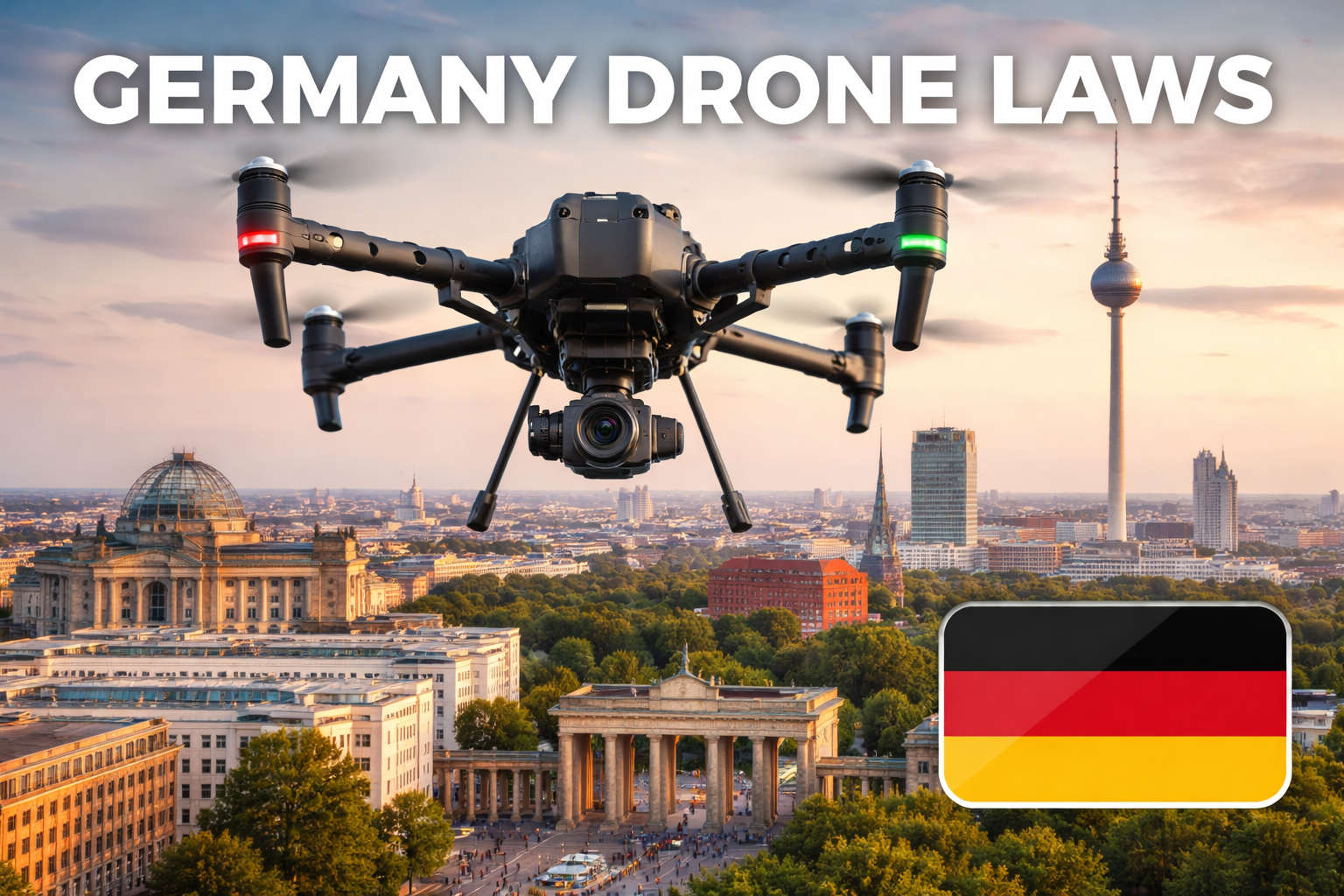
Europe EASA categories
EASA maintains “open category” guidance for low-risk operations and splits it into A1, A2, A3 subcategories.
For LiDAR work that pushes risk higher, teams move into specific category paths based on national implementations and SORA-style assessments.
United Kingdom updates
The UK CAA Drone Code states that new models placed on the market from 1 January 2026 must have a UK class mark (UK0 to UK6).
That impacts what aircraft can be flown in certain categories and is worth tracking if you operate in the UK.
Buying guide for Drone LiDAR in 2026
Start with your deliverable, not the sensor
Ask:
- Do you mainly deliver DTMs under vegetation
- Do you mainly deliver volumes and as-builts
- Do you map corridors
- Do you work indoors or GNSS-denied zones
Then map that to system traits:
- return capability
- scan geometry
- IMU quality
- processing workflow maturity
- aircraft endurance
Consider procurement constraints
Government and critical infrastructure work may require compliance constraints on aircraft and components.
For example, Ouster announced its OS1 lidar was approved under the US Department of Defense Blue UAS Framework in 2025.
If your clients care about that, it changes your sensor shortlist early.
What is next for Drone LiDAR?
A few trends are already visible
- Standards and reporting discipline keep tightening. USGS and ASPRS updates are a signal that buyers are getting more specific about acceptance tests.
- More hybrid workflows. Many systems now bundle LiDAR with multiple cameras for colorization and photogrammetry outputs.
- GNSS-denied mapping continues to grow. SLAM payloads and drones built for confined environments are now mainstream in mining and industrial inspection toolkits.
- Policy direction matters. BVLOS rulemaking paths will heavily influence corridor economics in regions where they mature.
Training and Certification for Drone Pilots.
Start Today at ABJ Academy.
Win Commercial Contracts. Grow your Career.
FAQs
What is drone LiDAR
Drone LiDAR is a method of collecting 3D point clouds by mounting a laser scanner on a drone and combining laser ranges with GNSS and IMU positioning.
What accuracy can you realistically expect from drone LiDAR?
You can often achieve centimeter-level accuracy, but your result depends on GNSS conditions, IMU quality, calibration, and how you test and report accuracy.
Do you need ground control points for drone LiDAR
You do not always need ground control points, but checkpoints are still the most straightforward way to prove accuracy to a client.
What is the difference between RTK and PPK for LiDAR mapping?
RTK applies corrections during flight while PPK applies corrections after flight using logged GNSS data, and both can support survey-grade results when configured well.
What does multiple returns mean and when does it matter?
Multiple returns means one laser shot can record several reflections, which matters most for vegetation where you want more chances to capture ground points.
Can drone LiDAR see through trees?
Drone LiDAR can often capture ground points under vegetation, but success depends on canopy density, return capability, flight planning, and season.
How do you compare LiDAR point rate to point density on the ground?
Point rate is a sensor output metric, while point density depends on altitude, speed, scan geometry, overlap, and surface reflectivity.
What file formats do clients usually want?
Most clients want LAS or LAZ point clouds, with LAZ commonly used to reduce file size for transfer and storage.
How much can LAZ reduce LiDAR file sizes?
LAZ can reduce file sizes dramatically, with an OGC LAZ 1.4 community standard description citing reductions up to about six times in NRCan’s context.
Can you process DJI Zenmuse L2 data outside DJI tools?
You can export standard point cloud formats like LAS from DJI’s workflow and then process downstream in other tools, even though DJI positions DJI Terra as the primary raw-data processor.
What outputs can DJI Zenmuse L2 export?
DJI lists point cloud exports such as PNTS, LAS, PLY, PCD, and S3MB, along with trajectory outputs like sbet.out and sbet.txt.
What is strip alignment?
Strip alignment is the step where overlapping flight lines are adjusted to reduce mismatches and systematic bias before classification and surface generation.
What is boresight calibration?
Boresight calibration is the process of estimating and applying angular offsets between the LiDAR sensor frame and the IMU frame so the point cloud aligns correctly.
Is a 905 nm LiDAR safe to operate around people?
Most mapping payloads classify the laser as Class 1, which is designed to be eye-safe under normal operating conditions, but you still need standard site safety controls.
What is USGS QL2 and should you care if you are outside the US?
USGS QL2 is a widely referenced LiDAR quality level tied to pulse spacing, density, and vertical accuracy targets, and it is a useful benchmark even for non-US projects.
What is a realistic use case for drone LiDAR on construction sites?
Drone LiDAR is commonly used for volumes, cut fill surfaces, and as-built comparisons because it produces stable 3D geometry and repeatable outputs.
Can drone LiDAR map power lines?
Drone LiDAR can map corridors and support clearance and encroachment analysis, and modern enterprise drones are also adding obstacle sensing features aimed at powerline environments.
What is SLAM LiDAR and when do you choose it?
SLAM LiDAR estimates motion from the sensor data itself and is commonly chosen for tunnels, mines, plants, and other GNSS-denied environments.
How fast can SLAM drones map a tunnel?
Some platforms publish tunnel mapping examples, such as Flyability citing coverage of a few hundred meters in a single flight under their stated conditions.
What is happening with BVLOS rules and why it matters for LiDAR?
BVLOS rulemaking matters because corridor mapping productivity grows sharply when you can legally fly longer linear routes, and the FAA has issued a BVLOS NPRM proposing performance-based regulations.
What is the biggest cause of poor LiDAR deliverables?
The biggest cause is usually weak trajectory quality or calibration issues, not the laser scanner itself, followed by rushed classification and weak QA.
Which software tools are commonly used for LiDAR processing?
Common tools include TerraScan for classification, LAStools for batch processing, LP360 for desktop workflows, LiDAR360 for large datasets, and PDAL for automated pipelines.


